
The water of the Baltic Sea is constantly moving
The sea is famously restless, and so is the Baltic Sea. The water in the Baltic Sea is constantly moving, both as surface currents and along the bottom. There are also vertical currents in the Baltic Sea that mix different water layers. Water currents are important for the sea’s well-being.
Water is set in motion due to winds, differences in air pressure, as well as density differences between different water masses. Together, all of these factors create a complex flow field, in which eddies or whirlpools occur. The size of such eddies varies from a few kilometres wide to tens of kilometres in diameter.
The Baltic Sea does not have the permanent ocean currents typical for the oceans; instead, surface currents mostly depend on the prevailing weather conditions. Currents are also influenced by the Earth’s rotation, which turns the water flow to the right when looking in the direction of flow. The shapes of the coastline, islands, and the seabed also guide the currents. Near the coast, the direction of the currents varies less than in the open sea.
Tides are negligible in the Baltic Sea. Therefore, they do not significantly affect the currents.
Surface currents may even reach one metre per second
Winds and freshwater flows into the Baltic Sea affect the sea surface, where they can produce brief currents, typically at speeds of five to ten centimetres per second.
In heavy storms, surface currents speed may reach 50 cm per second. Even greater speeds of over one metre per second, have been measured in narrow straits between basins, e.g. in the narrows between the Åland- and Bothnian Seas.
As a general rule of thumb, surface water flow rates measure approximately 0.1 metres per second. It can also be related to wind speed such that the former is often about 1-2 % of the latter.
Seawater is much heavier than air and thus, when it starts moving it does not stop very easily. Therefore, after strong winds calm, seawater can continue to flow noticeably quickly, even in totally calm weather.
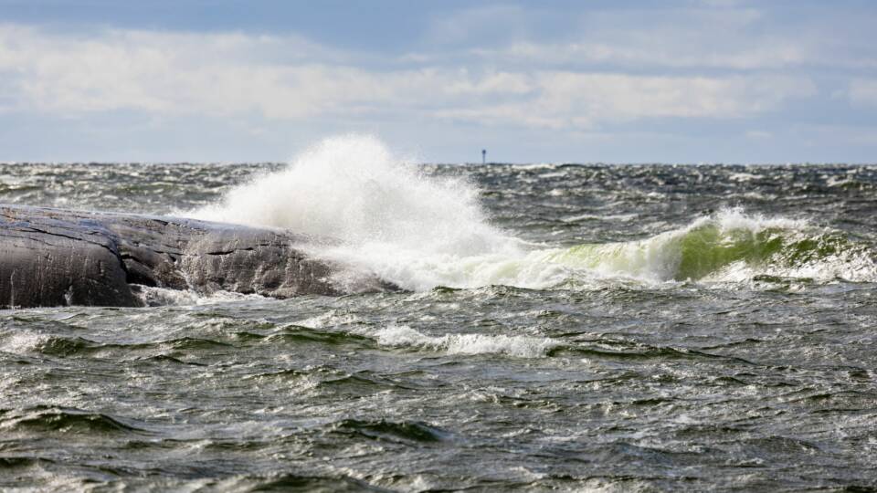
Deep-water currents bring new saltier water
Rivers and rainfall bring fresh water into the Baltic Sea, while salty water from the North Sea flows in through the Danish Straits. Salty water is heavier than fresh water, which is why it tends to move along the seabed. The shapes of the seabed guide the flow of the currents.
-
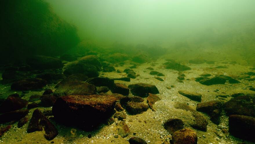 Find out more
Salt pulse
Bottom currents are slower than surface currents; they usually move only a few centimetres per second.
Occasionally, large amounts of salty ocean water enter the Baltic Sea through the Danish Straits. These salt pulses require particularly favourable weather conditions. The salty water usually flows along the seabed of the Baltic Sea, filling one basin after another. Along the way, it mixes with the older water of the Baltic Sea and becomes diluted. Salt pulses renew the deep waters isolated at the bottom of the basins.
A salt pulse progresses slowly, at about five centimetres per second, or 0.18 kilometres per hour. It takes about half a year for the saltwater to reach the Gotland Deep. It arrives in Finnish marine areas a few months later.
Sea level
The sea level of the Baltic Sea changes due to various natural phenomena
The total amount of water in the Baltic Sea varies somewhat depending on how much water flows out or in through the Danish Straits. However, local water levels are more affected by the movements of water masses within the Baltic Sea and differences in water density.
The Baltic Sea exchanges water with the ocean, and therefore the amount of water in the Baltic Sea varies somewhat. Strong winds tilt the water, packing it into the bottoms of bays, from where it flows back when the wind direction and speed change. Air pressure pushes the water, and variations in air pressure thus affect the water level.
In the Gulf of Bothnia, especially in its northern parts, the land is still rising after the Ice Age, which over time lowers the water level relative to the land. On the other hand, thermal expansion of the oceans and melting of continental glaciers raise the water level of the world’s seas. This effect is also visible in the Baltic Sea.
Wind, air pressure, and ice affect local variations
Tides affect the water levels on the Finnish coast by only a few centimetres. This effect is overshadowed by other movements of the water mass.
Strong southwesterly winds pack water into the bottoms of the Gulf of Finland and the Gulf of Bothnia, raising the water level there. Conversely, the water level drops above the wind. When the wind direction reverses, the water flows back, and the water level in the bottoms of the bays decreases.
High air pressure pushes the water level down. With low pressure, the water level rises slightly. A one-millibar difference in air pressure corresponds to approximately a one-centimetre difference in water level. Normal variations in air pressure can therefore lower or raise the water level by several tens of centimetres.
Sea ice also affects water levels. A continuous ice cover prevents the wind from affecting the water surface, so the wind cannot pack water against the coast. Ice thus mitigates water level variations: extreme water levels do not occur as easily as during ice-free periods.
Seiche – a standing wave
When wind-packed water meets the coast, the water flow stops and reverses. The water tries to return to its equilibrium position. This creates a standing wave motion, a seiche. The situation is the same – but on a much larger scale – as water sloshing from one side of a bathtub to the other.
The seiche wave depends on the length of the basin. The seiche is a typical phenomenon for the basin consisting of the Gulf of Finland, the central basin of the Baltic Sea, and the southern Baltic Sea. There, the seiche lasts for more than a day, and its effect on the water level is most pronounced in the bottoms of bays.
The total variation of Finnish sealevel is more than three metres
On the Finnish coastline, sea level variations are highest in the northernmost part of the Bothnian Bay and the eastern Gulf of Finland, The smallest variation is in Åland.
Winds and air pressure behave differently in different seasons, which is also reflected in sea level variations. The average sea level on the Finnish coast is highest in December during severe storms. It is at its lowest in April-May. However, the variation between years is significant.
Floods and low sea level
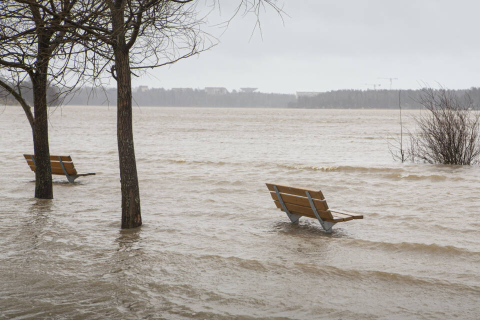
The most severe sea floods occur when the water volume of the Baltic Sea is large, the water has started to oscillate, and there is a deep low pressure near the coast, accompanied by strong winds. The flood risk is significant if the wind blows from a suitable direction while the standing Seiche wave pushes water into the bays.
Such a situation was experienced during the record storm surge on the Gulf of Finland and the eastern coast of the Baltic Sea on the 9th of January 2005, when the sea level rose more than a metre above normal.
Exceptionally low sea water also requires special conditions. Low sea water causes problems, among other things, for shipping.
Upwelling
Upwelling brings deep water layers to the surface
Many have experienced that seawater has suddenly become colder, even on a warm summer’s day. What in the world could have happened?
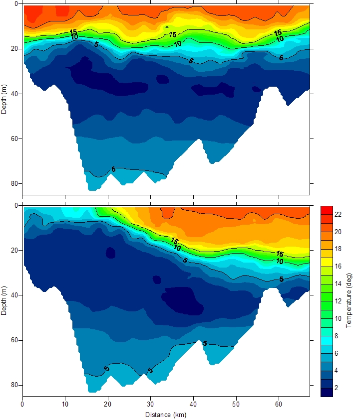
This phenomenon is quite common and is due to upwelling, i.e. the transport of cold deep layers to the water’s surface. In the Baltic Sea, water wells up from depths of a few tens of metres.
Water currents created by winds cause upwelling. A typical upwelling situation occurs when the wind blows along the coast, i.e. from right to left when viewed from the beach. The Coriolis phenomenon of the Earth’s rotation, which turn currents to the right in the northern hemisphere, causes coastal waters to drift offshore.
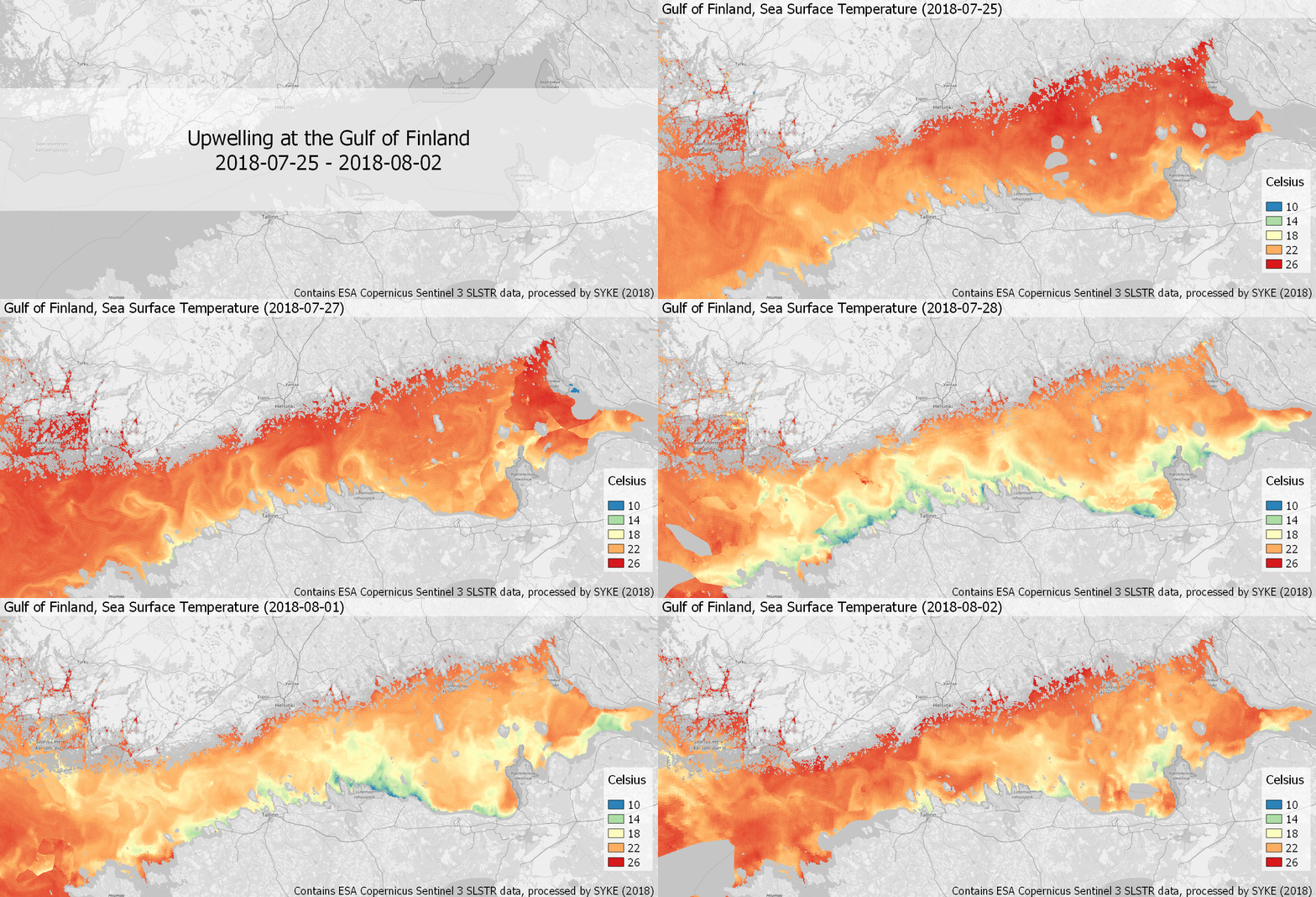
In turn, this offshore drifting water is replaced by upwelling water flowing from the depths to the surface. To be clear, this is not a case of rapid cooling, rather the warmer water has simply been replaced by cooler water. A typical upwelling zone extends along the coastline extends outwards from about 5 to 20 kilometres from the shore to the open sea. This area of cold water is easily visible in satellite images too.
Upwelling requires time
Upwelling is not instantaneous because the large mass of the seawater opposes movement. For example, in the Gulf of Finland, it is necessary for moderate winds to blow along the coast for at least a couple of days before upwelling can begin.
When upwelling starts, the surface water temperature can drop by more than ten degrees overnight. Swimmers at beaches may experience unpleasant surprises when the warm water from the previous day has turned cool, even though the air temperature remains just as warm as before.
After upwelling, temperature differences begin to even out; currents and solar radiation warm the surface water again. However, the effects of upwelling can sometimes be visible in the sea water temperature for up to a couple of weeks.
Upwelling can promote algal growth
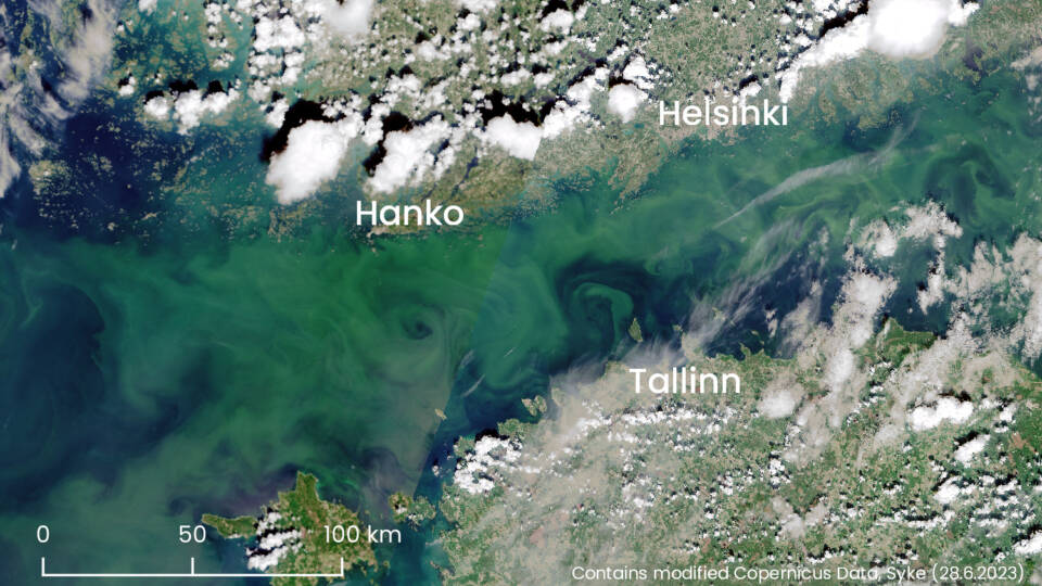
By bringing nutrients to the surface, upwelling can promote the growth of planktonic algae, including the formation of blue-green algal blooms. Although the surface water itself may be too cold immediately after upwelling for algae growth, it will accelerate during the next warm and calm period. This scenario occurs often in August in the Gulf of Finland.
Waves
Baltic Sea waves are created by the wind
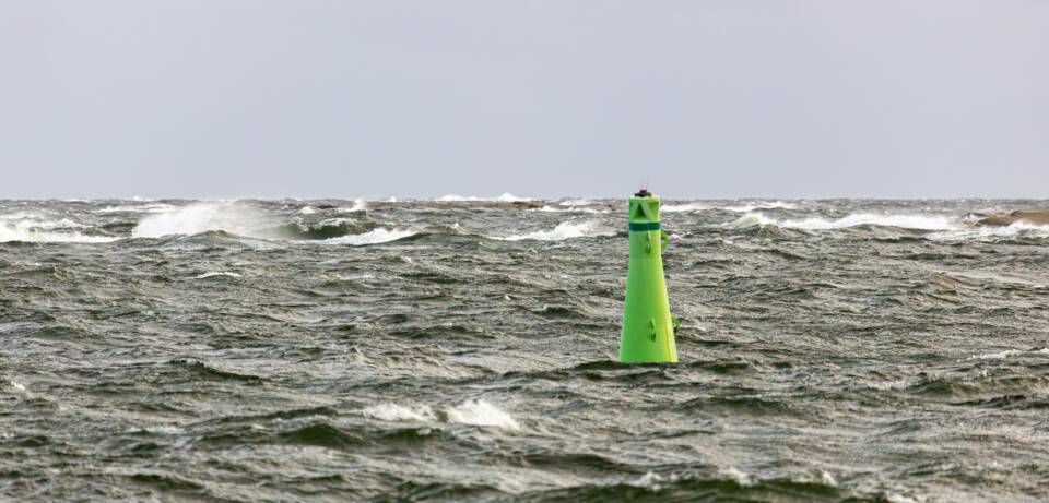
Waves are perhaps the most impressive form of sea motion that people normally associate with the sea. They occur when the wind blows over a calm water surface, causing the water to flow and creating turbulence. Turbulence creates pressure differences which disrupt the smooth water surface. The wind is able to “grab” the ripples created on the surface and makes them larger.
Small waves are initially steep-sided but they become more gradual as they grow: their length increases more than their height. . As the waves lengthen, they start to move faster. Waves interact with each other, transferring energy between them. Soon there are many waves of different heights, lengths, and directions. Such wind-generated waves are highly irregular in nature.
The sea surface is not only a passive playground for the wind. The moving waves, with varying sizes and their occasional breaking, affect the air mass above the sea. For example, they can alter the winds, which in turn regulate the waves.
The duration of the wind and the size of the open water regulate the waves
The growth of waves is influenced not only by the wind speed but also by how long the wind lasts and the length of the fetch. Fetch refers to the distance over which the wind can affect the water’s surface. Essentially, it is the distance from the upwind shore.
If the wind continues to blow steadily and the fetch does not limit the growth of the waves, the waves become fully developed. In fully developed waves, the waves move at the same speed as the wind. Such waves occur on the open oceans.
In the Baltic Sea, the fetch is too short for the waves to become fully developed. Therefore, the fetch regulates how high the waves can grow at different wind speeds. The highest waves occur in the northern parts of the main basin of the Baltic Sea, where the open water is widest.
The salinity or temperature of the water does not significantly affect the waves. However, the temperature difference between the water and the air can influence wave growth. Growth is faster when the water is warmer than the air and slower when the water is colder than the air.
Waves are measured in height and length
The height of a wave is the distance between its trough and crest. Since waves are in various heights, the height of the wave field is described using the term significant wave height. This refers to the average height of the highest third of the waves in a probability distribution of wave heights. Practically, this corresponds quite well to the wave height that an experienced observer would visually estimate as the average height of the wave field.
The highest individual waves can be about twice as high as the significant wave height. In the Baltic Sea significant wave heights greater than eight metres have been recorded, with over 14 metres high individual waves.
The largest waves in the Bothnian Sea are almost as large as those in the northern Baltic Proper, whereas those on the Bothnian Bay and the Gulf of Finland are slightly smaller. Wave heights have been measured in Finnish sea areas since the 1970s.
The shape of the water area and its depth also influence wave growth. Waves begin to feel the effect of the bottom when the water depth is less than half the wavelength.
The wavelength is the distance between two successive crests. When waves arrive in shallow water, their wavelengths become shorter, steeper, and they finally break. In sufficiently shallow water, waves can remove material from the bottom, including sediments and nutrients.
Swells travel long distances
Even after the wind calms down, the sea state continues for a while. The speed of the waves is then greater than the wind speed. Gradually, however, the waves diminish, with the smallest waves fading first, as the wind no longer supplies energy to the waves. The surge turns into a swell, which is transported away.
Swells also refer to waves generated by distant storms. In the open oceans, swells can travel thousands of kilometres with little attenuation before breaking on the shallow waters of the coast. Breaking swells often create impressive surf.

