The Baltic Sea is small and surrounded by several states
The Baltic Sea is a small sea on the northeastern edge of the Atlantic Ocean surrounded by landmasses in nearly all directions. Its surface area is slightly larger than Finland’s and its mean depth is only 54 metres.
-
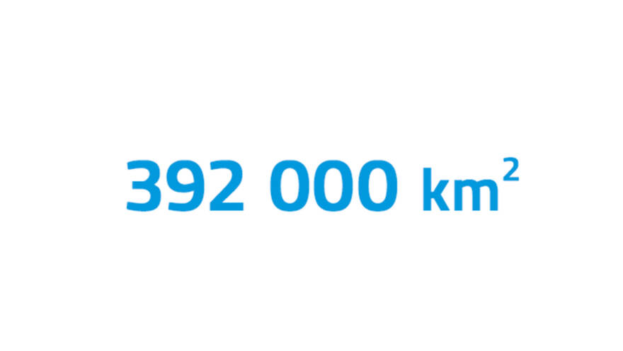
Surface area
The Baltic Sea’s surface area is around 392,000 square kilometres which is 0,07 percent of Earths total surface. It is the second largest brackish water basin, only the Black Sea is larger.
-
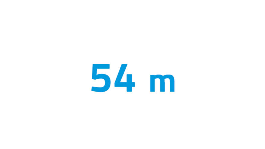
Average depth
The Baltic Sea is only 54 metres deep on average. For example, the average depth of the great oceans is around 3,700 metres, while the average of the Mediterranean Sea is 1,500 metres.
-
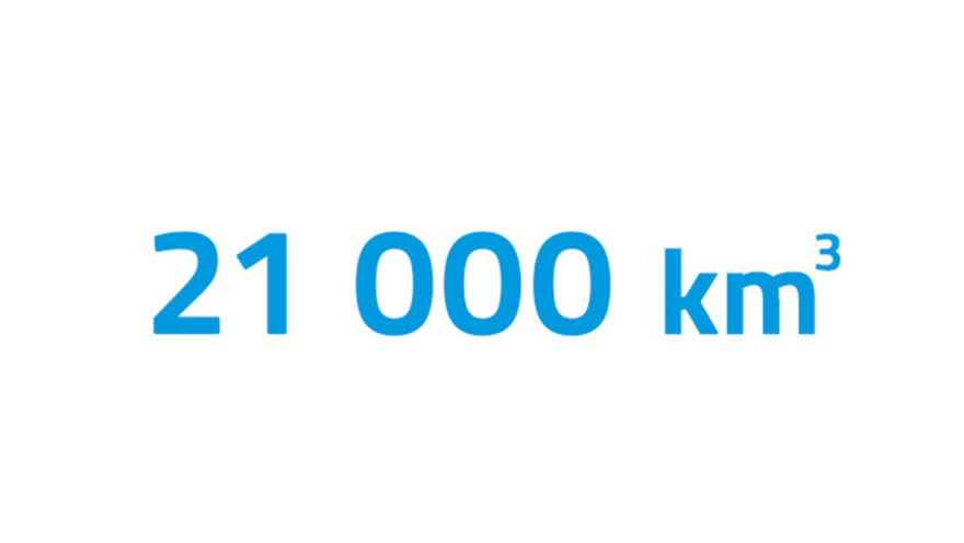
Volume
The Baltic Sea’s volume is around 21,000 cubic kilometres which is less than one percent of the surface area and volume of the Atlantic Ocean.
-
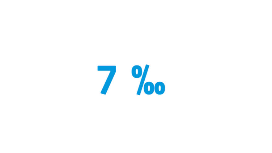
Salinity
The salinity of the Baltic Sea is 7 per mille, which is one-fifth of the salinity of the great oceans. The salinity decreases towards the ends of the Gulf of Bothnia and the Gulf of Finland.
The Baltic Sea has a large catchment area
The Baltic Sea catchment area – the area from which rainwater flows into the Baltic Sea in rivers – is four times the surface area of the Baltic Sea. As the volume of the sea is small, its ability to dilute substances leached from the catchment is poor. The Baltic Sea is only connected to the ocean through narrow and shallow straits, which is why its water also exchanges slowly, and any substances that have entered the sea stay there for a long time.
As the water exchange between the Baltic Sea and the ocean is limited and freshwater from the catchment is continuously flowing into the Baltic Sea along numerous rivers, the water is always brackish with low salinity. The freshest water in the Baltic Sea is found in large estuaries, including in the Bothnian Bay and off St. Petersburg.
-
Catchment area
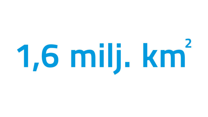
The Baltic Sea catchment area extends to 1.6 million square kilometres, or four times the surface area of the Baltic Sea.
-
Inhabitants
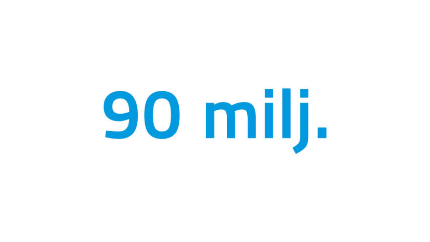
Almost 90 million inhabitants in 14 countries live in the Baltic Sea’s catchment. There are nine actual coastal states.
Seabed topography divides the Baltic Sea into basins
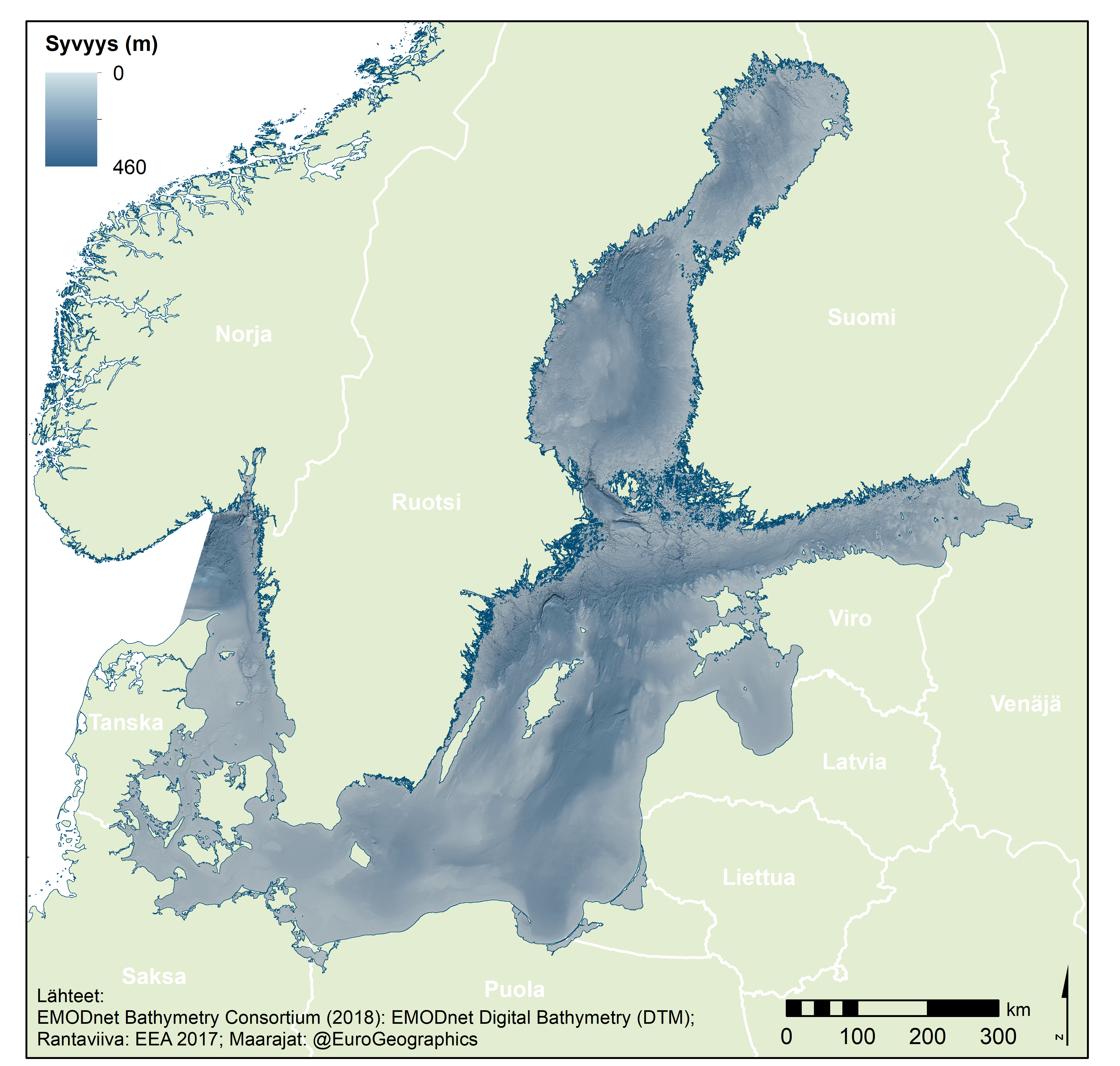
The Baltic Sea is divided into 14 marine areas. The division is partly based on the shapes of the seabed and the natural basins they form. Partly, it is about agreed boundaries.
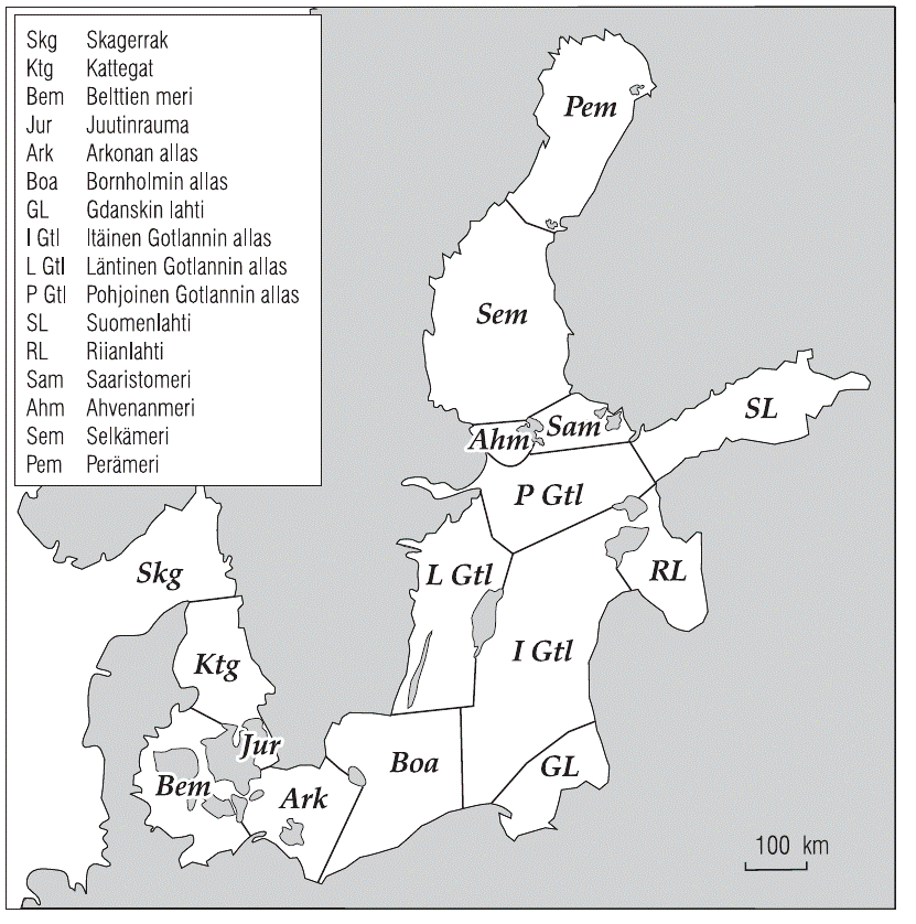
Characteristics of the Baltic Sea by marine area. (Source: Myrberg et al. 2006)
The Danish straits
The narrow straits of Denmark are vital for the Baltic Sea, as they are the only connection between the Baltic Sea and the oceans. The outer boundary of the Baltic Sea is defined by the border between the Danish straits and the Kattegat.
The Danish straits refer to two adjacent waterways that connect the Baltic Sea to the North Sea. One of these narrow waterways is the Sound (Öresund), which runs between the southern coast of Sweden and the Danish island of Zealand. The other is the Belt Sea, located between the island of Zealand and the Jutland Peninsula. It is divided into two straits: the Great Belt and the Little Belt.
All these straits are shallow, which limits the water exchange between the Baltic Sea and the North Sea. The shallowest is the Öresund, with a minimum depth of only 7–8 meters. Another shallow point is in the Belt Sea, south of the Danish straits. This Darss Sill rises to 18 meters above sea level. It determines what types of vessels – how deep-draft ships – can enter the Baltic Sea.
The Arkona Basin, Bornholm Basin and Gotland Basin
When a ship entering the Baltic Sea passes through the Danish straits, it first encounters the Arkona Basin, located between Sweden and Germany. From there, the ship continues its journey to the Bornholm Basin, which spreads out east of the island of Bornholm.
Further east or north, the Gotland Basin is encountered. It is divided into three parts: the eastern, western, and northern Gotland Basins. On the side of the eastern basin, there are two large bays: the Bay of Gdańsk in the south and the Gulf of Riga further north.
The extensive area covered by the Arkona, Bornholm, and Gotland Basin is often referred to as the Baltic Proper or alternatively the main basin of the Baltic Sea. Here, the sea depth generally varies between 50 and 100 meters, but in some places, it exceeds 200 meters.
The shallowest areas of the proper Baltic Sea are in the south. The deepest point, however, is located in the northern part of the western Gotland Basin. This Landsort Deep reaches 459 meters, making it the deepest point in the entire Baltic Sea.
Sea areas surrounding Finland
The sea areas surrounding Finland are bordered to the south by the northern Gotland Basin. The Gulf of Finland is a direct extension of the Gotland Basin, as there are no bottom ridges or sills at the mouth of the gulf to restrict water circulation. The average depth of the Gulf of Finland is 37 meters. The deepest point, at 123 meters, is located off the northwest coast of Estonia.
The northernmost basin of the Baltic Sea is the Gulf of Bothnia, which is quite separate from the rest of the Baltic Sea. The Gulf of Bothnia is divided into the Archipelago Sea, the Åland Sea, the Bothnian Sea, and the Bay of Bothnia. The deepest point in the Bothnian Sea is 293 meters, and in the Bay of Bothnia, it is 146 meters. These depths are closer to Sweden than to Finland.
Between the Bothnian Sea and the Bay of Bothnia lies the narrow and shallow Kvarken, with a sill depth of only 25 meters at its deepest, which restricts water flow. The fragmented Archipelago Sea also slows the movement of seawater from the main Baltic Sea to the Bothnian Sea.
The Åland Sea is located in a fault zone, and its bottom features are steep. In the strait between Åland and Sweden, near the Märket lighthouse, the 300-meter mark is broken. The exact depth is 301 meters. This is the only area in the Baltic Sea where such great depths are reached close to land.
| Sea basin | Surface area (km2) | Mean depth (m) | Deepest depth (m) | Volume (km3) |
|---|---|---|---|---|
| the Baltic Sea (with danish straits) | 392,978 | 54 | 459 | 21,205 |
| the Baltic Sea (without danish straits) | 372,857 | 56 | 459 | 20,918 |
| Danish straits | 20,121 | 14 | 81 | 287 |
| Belt sea | 17,821 | 15 | 81 | 260 |
| Öresund | 2,300 | 12 | 53 | 27 |
| Arkona basin | 19,068 | 23 | 53 | 442 |
| Bornholm basin | 38,942 | 46 | 105 | 1,780 |
| Gotland basin | 151,920 | 71 | 459 | 10,824 |
| Bay of Gdansk | 25,234 | 57 | 114 | 1,439 |
| Eastern Gotland basin | 63,478 | 77 | 249 | 4,911 |
| Northern Gotland basin | 28,976 | 71 | 150 | 2,056 |
| Western Gotland basin | 34,232 | 71 | 459 | 2,418 |
| Gulf of Finland | 29,498 | 37 | 123 | 1,098 |
| Gulf of Riga | 17,913 | 23 | 51 | 405 |
| Gulf of Bothnia | 115,516 | 55 | 293 | 6,369 |
| Sea of Åland | 5,477 | 75 | 301 | 411 |
| Archipelago Sea | 8,893 | 19 | 104 | 169 |
| Bothnian Sea | 64,886 | 66 | 293 | 4,308 |
| Bothnian bay | 36,260 | 41 | 146 | 1,481 |
-
 Find out more
Characteristics of water
-
 Find out more
Marine habitats