
The seabed is like a roller coaster
Contents
Different shapes of the seabed
The bottom topography of the Baltic Sea varies greatly by region. The northern Baltic Sea features significantly more fractured formations compared to the southern areas. In the south, the irregular seabed is smoothed by sedimentary rocks covering the bedrock. These hard bottoms are typically covered by bedrock, boulders, or gravel. Soft bottoms, on the other hand, are covered by sand, clay, or mud. The seabed of the Baltic Sea itself consists of ancient bedrock that is two billion years old.
-
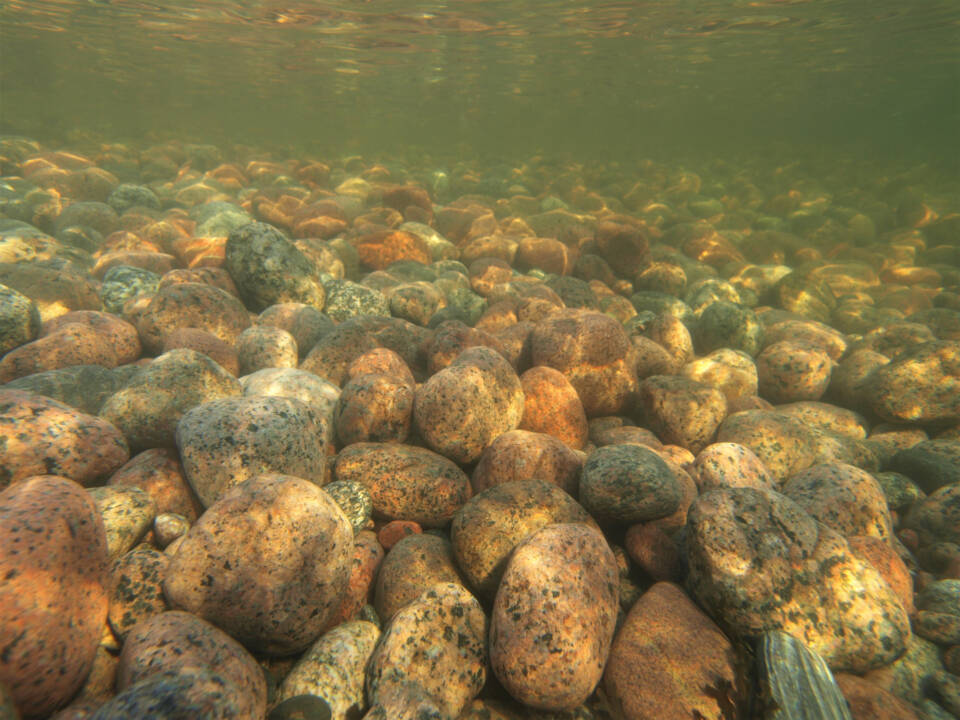
Stony bottom underwater -
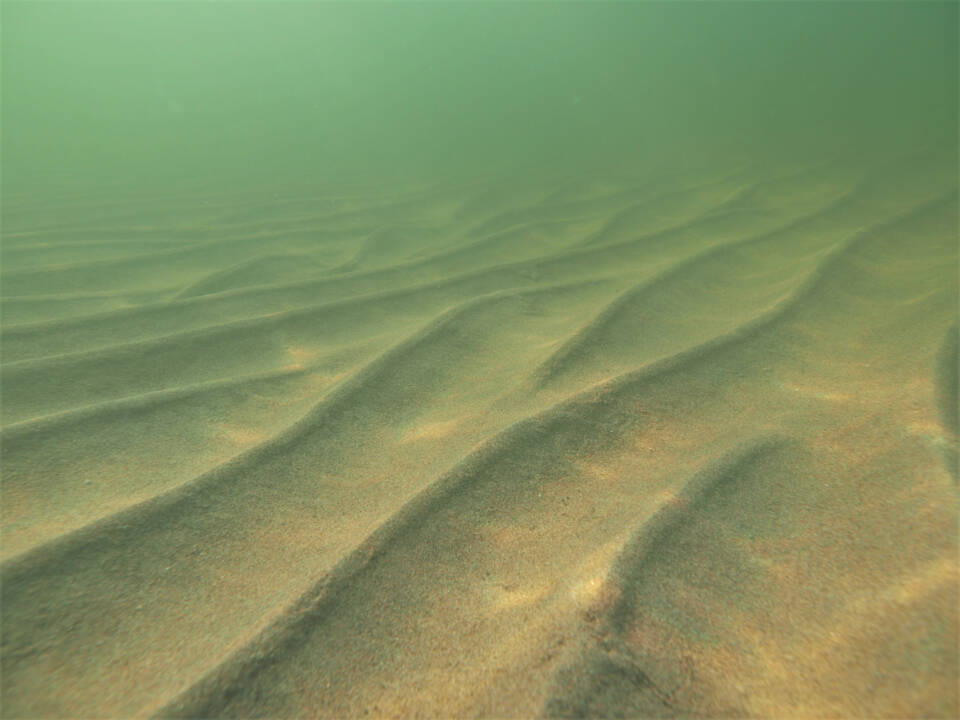
Sandy bottom underwater -
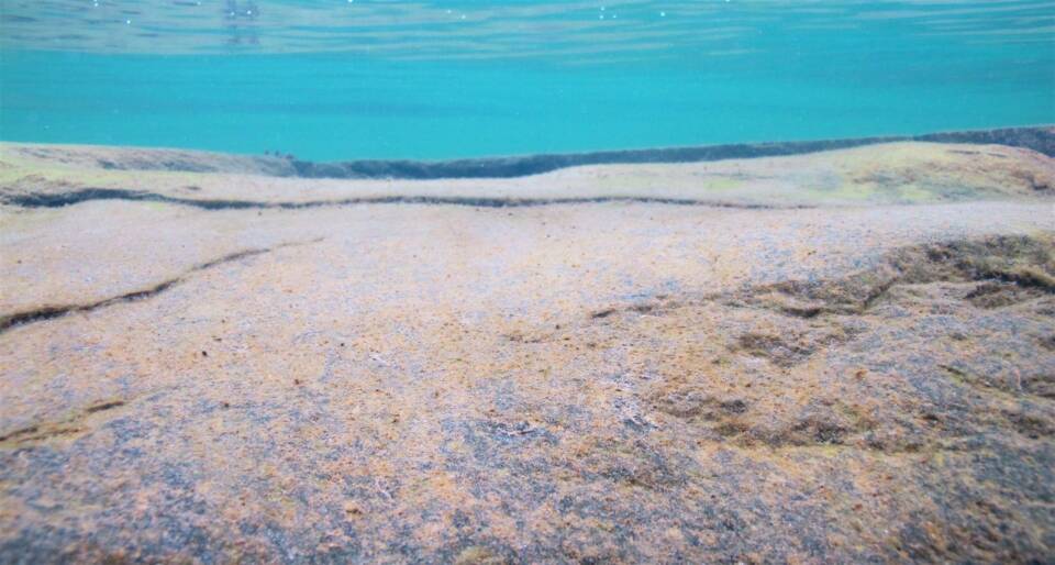
Bedrock bottom -
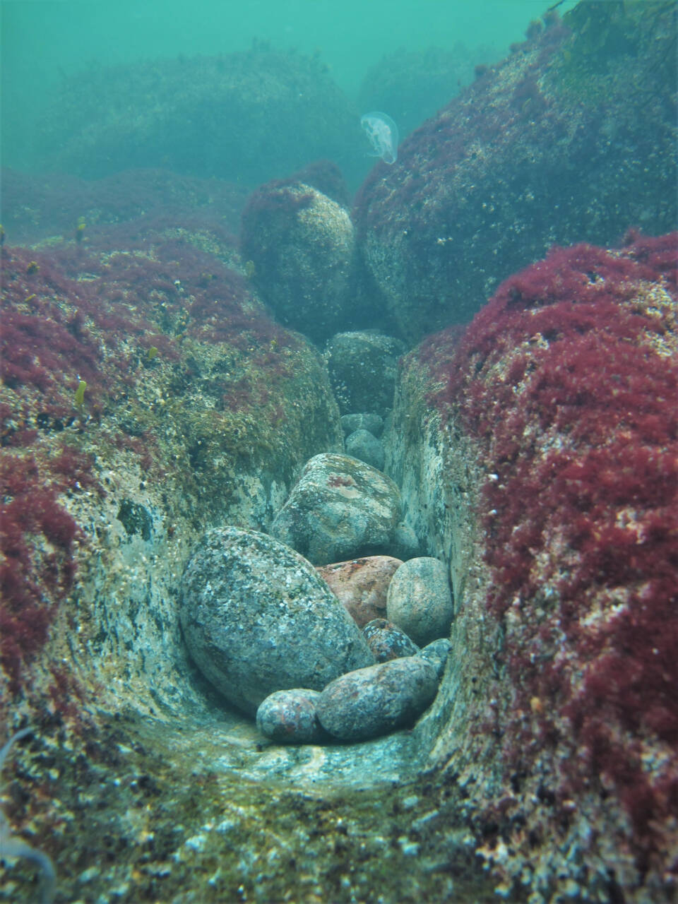
Bedrock bottom
The Baltic Sea is a shallow sea
Mannerlaattojen yhtymäkohtiin syntyy yleensä syviä kohtia, joiden päällä valtameret lepäävät. Itämeri on kuitenkin kokonaan Euraasian mannerlaatan päällä ja tästä syystä se on mereksi matala. Itämeren keskisyvyys on vain noin 54 metriä, jos siihen upotettaisiin Helsingin stadionin torni, jäisi tornista näkyviin vielä 18 metriä.
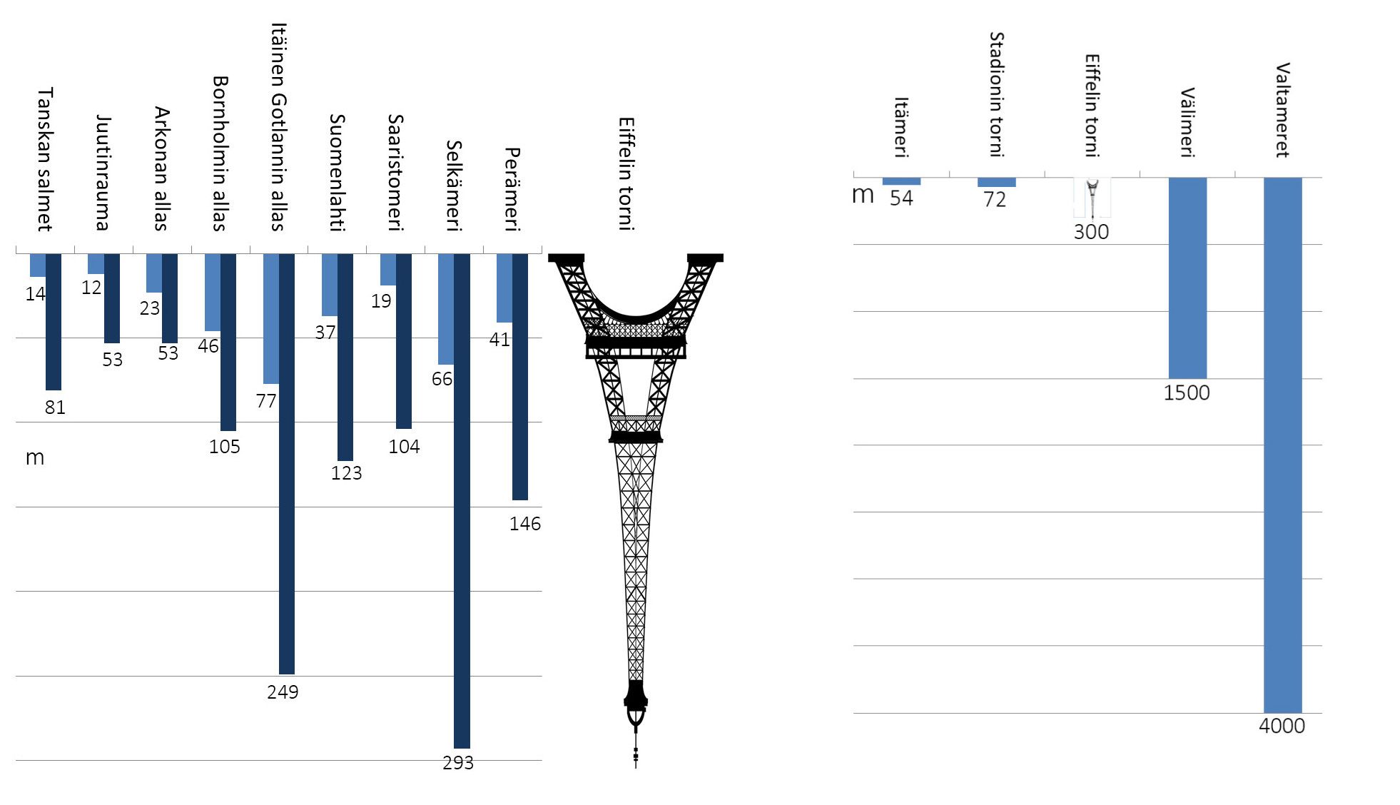
The deepest point in Finland’s maritime territory is located in the Bothnian Sea, reaching a depth of 293 meters. The deepest point in the entire Baltic Sea, however, lies within Swedish waters, between Stockholm and Gotland, in the Landsort Deep. It plunges to 459 meters—deep enough to stack one Eiffel Tower and a couple of stadium towers on top of each other.
For comparison, the average depth of the world’s oceans is about 4,000 meters, and the deepest known point is just under 11,000 meters.
Due to the Baltic Sea’s shallowness, its water volume is relatively small—meaning there’s little water in relation to its surface area. As a result, harmful substances entering the sea dilute only slightly, making the Baltic Sea highly sensitive to environmental changes.
Sisältö vaatii markkinointievästeiden sallimisen. Ole hyvä ja salli evästeet katsoaksesi sen.
The Baltic Sea is in constant transformation due to post-glacial land uplift. The depression caused by the continental ice sheet—now occupied by the Baltic Sea—is still gradually leveling out. In the sea’s region, the land is slowly rising, reshaping coastlines and archipelagos. New islands emerge, while others merge with the mainland or neighboring islands.

Did you know?
MerenkurkuThe Kvarken Archipelago land uplift area in the Gulf of Bothnia is a UNESCO World Heritage Site.