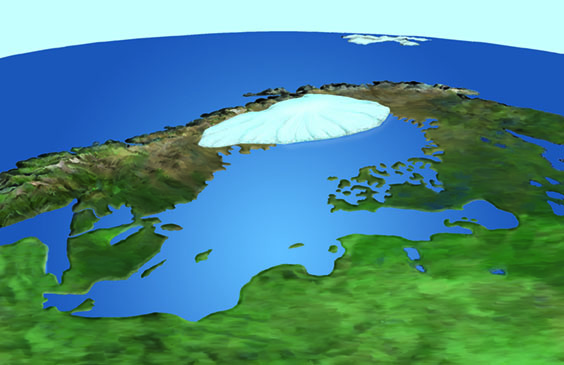
The Baltic Sea has developed into its present form over thousands of years
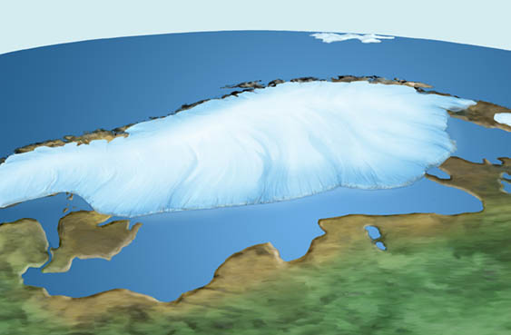
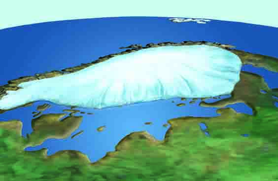
The Baltic Sea basin has existed as a depression in the bedrock for 500–600 million years. However, it was only during the retreat of the last Weichselian glaciation that the continental ice sheet scoured and shaped the basin into its present form.
Eero Ojanen, Olli Jalonen ; Ten Millennia: Stories from Finnish History
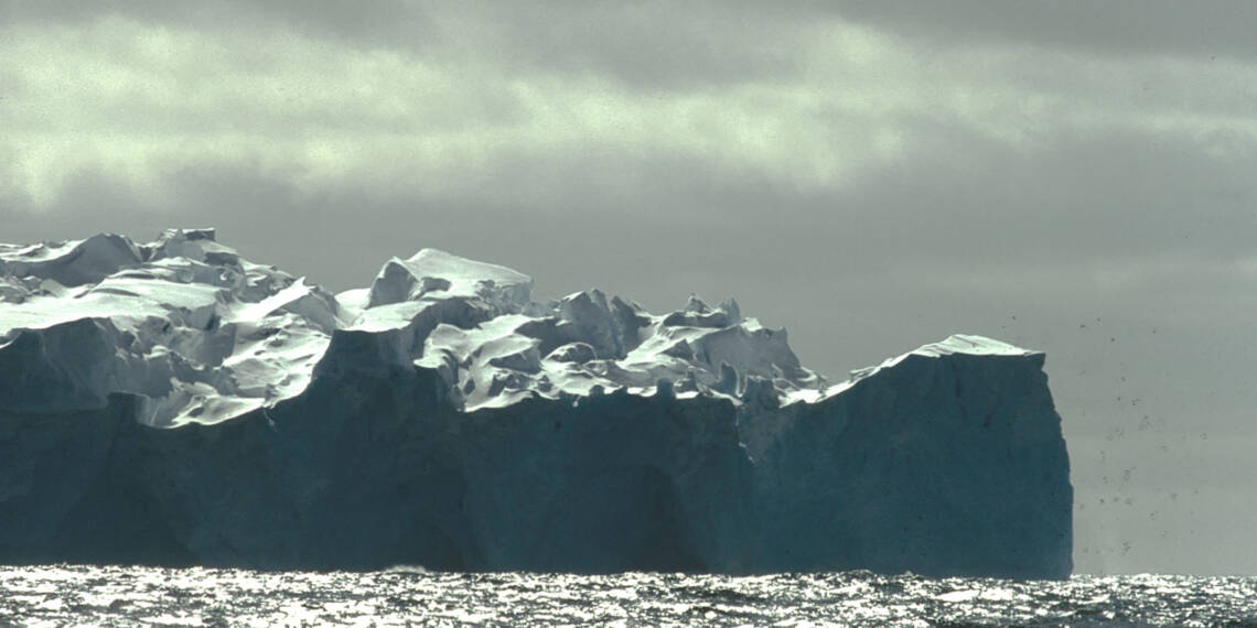
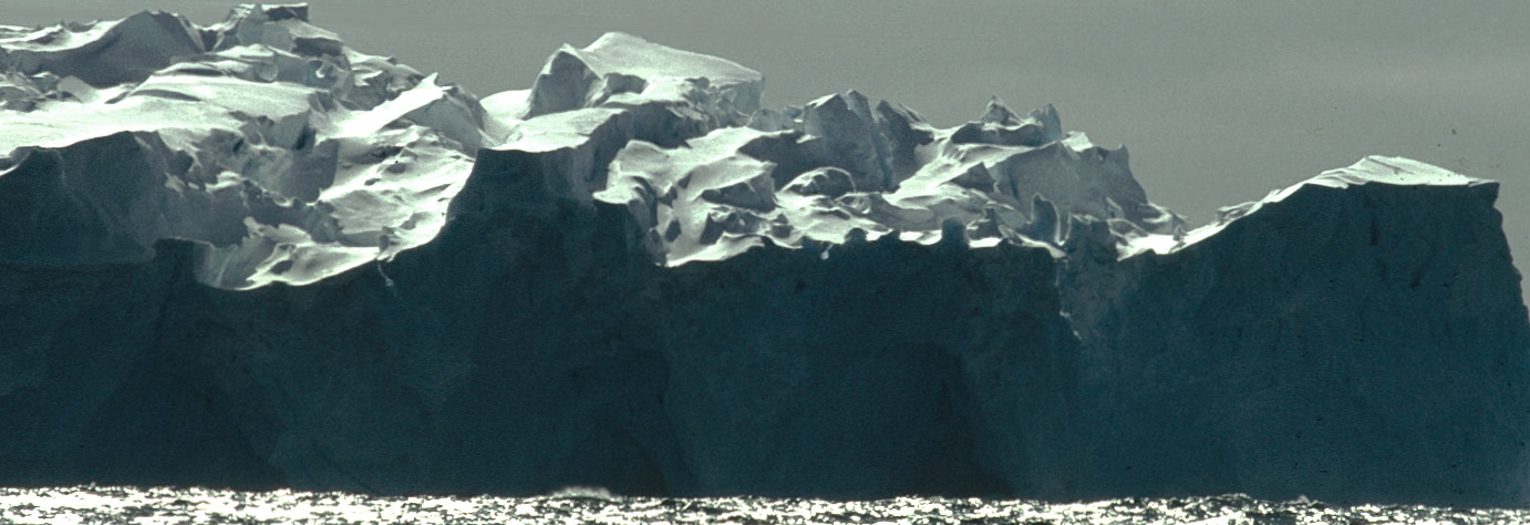
“Back when I was a boy and my father brought me here with him, he told me that his own father—or someone long before—had once rowed so far north that he saw a great, towering, misty, glowing edge of ice. There, in the icy water, a new islet grows every evening. When the sun melts the ice all the way to the bottom, stones break free from within the ice blocks and scatter into reefs….”
Iceberg in Antarctica. Kuva:
Twenty thousand years ago, a continental glacier up to three kilometers thick in places covered the Baltic Sea region. The massive ice sheet pressed the ground downward into a deep depression.
As the climate gradually warmed, the immense glacier began to melt. Torrents of meltwater surged through the melting ice. At the misty edge of the bluish glacier, a vast Baltic Ice Lake formed, with its surface rising tens of meters above sea level due to the influx of meltwater. The ice lake covered parts of the Baltic region and all of southern Finland up to the Salpausselkä ridges.
Over the course of the following thousands of years, the sea level of the ocean fluctuated, and the bedrock “breathed,” opening and closing the connection to the ocean. The salinity of the water area changed depending on how much ocean water was able to flow into the region.
For several thousand years after the end of the ice age, the Baltic Sea basin had no connection to the ocean, and the area was dominated by freshwater lakes. Eventually, a wide enough passage opened in what is now central Sweden, allowing highly saline ocean water to flow into the basin: the brackish Yoldia Sea was formed around 11,000 years ago.
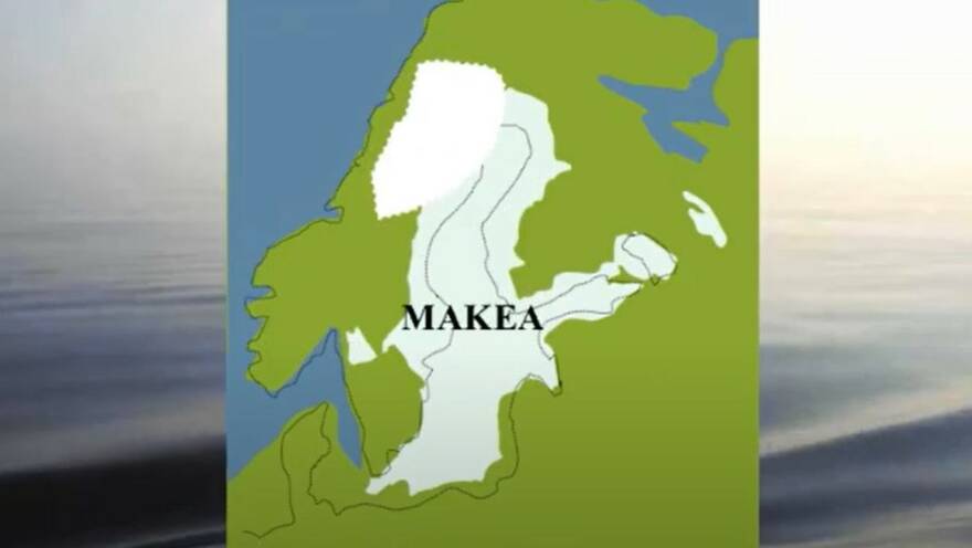
Around 10,000 years ago, the Baltic Sea basin once again held freshwater, forming the Ancylus Lake, whose surface was higher than that of the ocean.
The most recent brackish water phase of the Baltic Sea, with higher salinity than today, began when a connection to the North Sea opened through the Danish straits. As the ocean level rose, salty water quickly flowed into the Baltic. The freshwater Ancylus Lake transformed into the Littorina Sea in a short time, around 9,000 years ago.
As the continental ice gradually melted, the pressure of the massive glacier eased, and the deep depression it had pressed into the ground began to rebound. Land uplift and falling sea levels revealed more and more land from beneath the water.
The remaining fragments of the Fennoscandian ice sheet melted about 8,500 years ago.
The salinity of the Baltic Sea varied depending on how much salty ocean water could flow into the region. For example, around 4,000–6,000 years ago, the Danish straits were deeper and wider than they are today. At that time, large volumes of ocean water entered the Baltic, and the salinity rose to eight times the level of today’s Baltic Sea.
Currently, highly saline water from the North Sea can enter the Baltic only through the narrow Danish straits, while hundreds of rivers continuously flow freshwater into the sea. That’s why the Baltic Sea is a relatively low-salinity inland sea with slow water exchange. The brackish sea we know today has only existed in the Baltic basin for a few thousand years—a short time in the life of a sea.
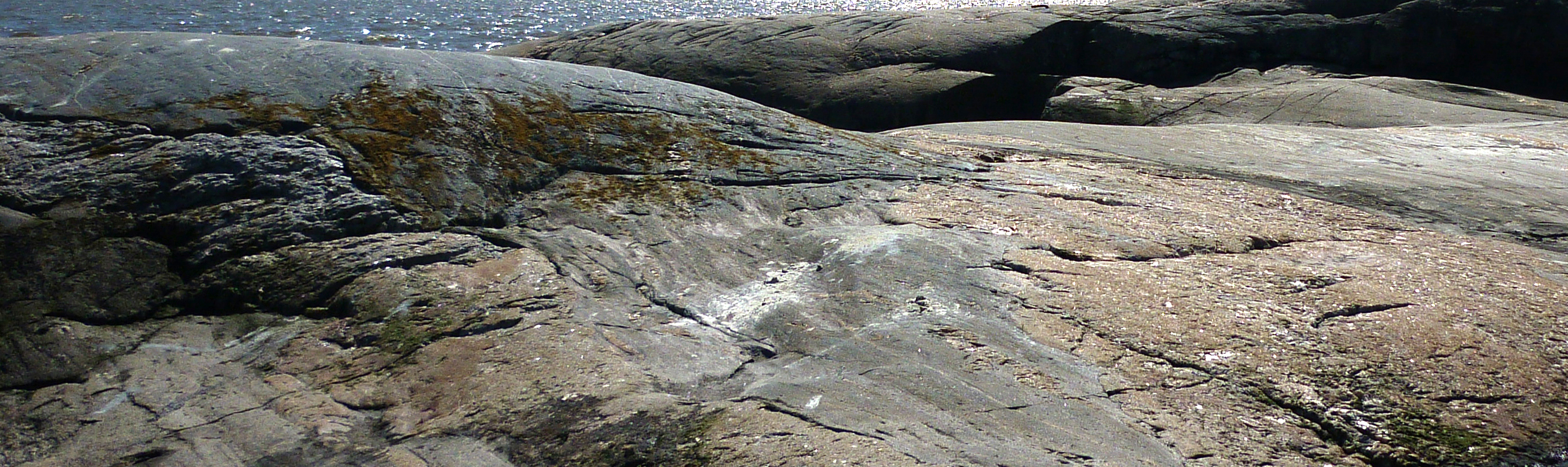
The glacial ice furrowed the ancient bedrock in the Baltic Sea area.
Eija Rantajärvi
The legacy of the ice age continues to shape the coastline
The depression pressed into the ground by the continental ice sheet of the last ice age continues to slowly rebound even today. Immediately after the ice melted, the rate of land uplift was about ten times higher than it is now. This uplift has created—and continues to create—most of the islands in our marine areas.
The coastline of the Baltic Sea is still evolving. As the land gradually rises, the archipelago of the Baltic Sea is slowly changing. New islands emerge while others disappear as they merge with the mainland or with neighboring islands.
The speed at which the ground is currently rising, mm/year. Map: Vestöl, Ågren, Svensson. Background image: Metsähallitus
Ulrika Björkman, Metsähallitus
Land uplift is fastest in the Bay of Bothnia and the Kvarken region, where the ground rises by 9 millimeters per year: around one hundred hectares of new land emerge in the archipelago annually. The change can be observed within just a few years, as new islets rise, old ones grow into islands, and sea bays transform into fladas and gloe lakes.
did you know?
The flow directions of present-day rivers suggest that ancient rivers also once flowed toward the center of the Baltic Sea basin.
The last continental glacier carved away a layer about seven meters thick from the surface of the bedrock and carried it away in fragments.
De Geer -moreenit muodostavat erityiDe Geer moraines form long, parallel islands especially in the Kvarken Archipelago.
Tanskan salmissa, Itämeren eteläosassa, maa ei enää In the Danish straits, located in the southern part of the Baltic Sea, the land is no longer rising but sinking.
In a few thousand years, the Bay of Bothnia will have become a large lake.
KRuggedly beautiful outer islets of the archipelago in the Gulf of Finland. The rocky islands bear the sculpted forms left by the ice age. The outer sea islands are mostly bare-shored islets, where grass, reeds, and shrubs grow; trees are found only on the larger islands. In the inner archipelago and along the coast, even small islands support tree growth. Photo: