
Maritime cultural heritage in international projects
Project collaboration is part of the international operations of the Finnish Heritage Agency and this authority participates in many international maritime projects. The information compiled by such projects is also used to benefit the development of the entire cultural heritage sector in Finland.

The underwater cultural heritage of the Baltic Sea is recognised globally as being exceptionally diverse and well preserved. This rich cultural heritage is involved in the maritime spatial planning of the Baltic Sea area and the utilisation of its tourism potential.
Between 2017 and 2020, the BalticRIM project integrated maritime and underwater cultural heritage into maritime spatial planning. Meanwhile, the Baltacar project, carried out between 2017 and 2019, promoted wreck diving tourism by creating so-called wreck parks.
Maritime spatial planning is still a current theme in Europe
Through maritime spatial planning, we can promote the sustainable development and growth of a sea area’s various uses and achieve good environmental status in the marine environment. Cultural heritage is a form of use in the same way as fishing, shipping, and marine wind farms.
Marine spatial planning is based on the EU’s Maritime Spatial Planning Directive, which was drafted in 2014. In Finland, three maritime spatial plans were prepared by the regional councils along the coast in cooperation, to be completed by the end of March 2021. Åland is preparing its own plan.
The BalticRIM project (Baltic Sea Region Integrated Maritime Cultural Heritage Management) brought maritime and underwater cultural heritage into maritime spatial planning in the Baltic Sea region. The project raised awareness of the significance, phenomena, and sources of maritime cultural heritage, as well as its role as part of blue growth.
As a result of the project, cultural heritage gained visibility in national maritime spatial planning processes, documents, and plans, as well as in international maritime spatial planning seminars. At the same time, cooperation was strengthened between maritime spatial planners, cultural heritage experts, and the main maritime spatial planning body in the Baltic Sea region, HELCOM-VASAB.
The project’s final report and handbook summarize its recommendations, best practices, and overviews of maritime spatial planning and practices in different countries. The project website, Data Portal, and WIKI page provide more detailed information on the project’s work packages, themes, maritime and underwater cultural heritage in the Baltic Sea, terminology, and results.
The project partners were national experts on cultural heritage management and maritime spatial planning in the Baltic Sea region from Germany, Estonia, Lithuania, Poland, Denmark, and Russia. The project was led by the Archaeological Department of the province of Schleswig-Holstein. Finnish project partners included the Finnish Heritage Agency, Metsähallitus, and the University of Turku. Other national partners are the Cultural Agency of the Provincial Government of Åland, the Kymenlaakso Association, and the Finnish Divers’ Federation.
What did the BalticRIM project do in practice?
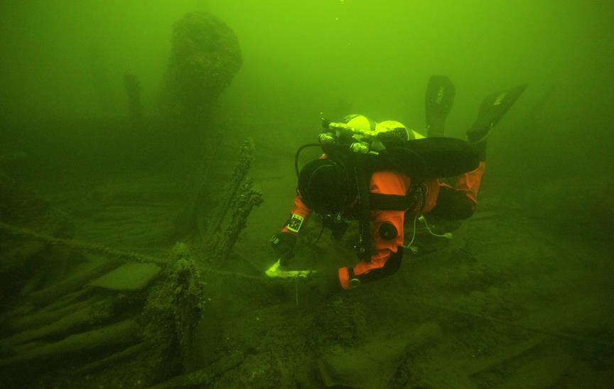
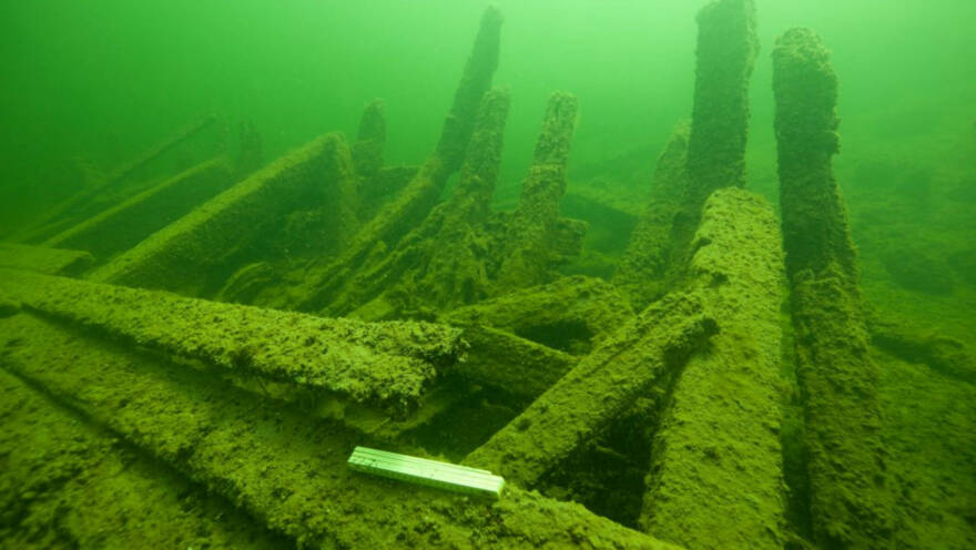
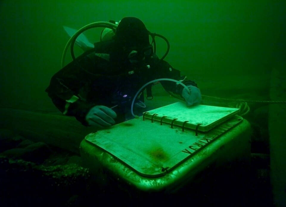
In the BalticRIM project, underwater fieldwork was carried out in various parts of the Baltic Sea and Finland. In Finland, the Finnish Heritage Agency and Metsähallitus jointly carried out fieldwork for the BalticRIM project in 2018 and 2019 in Jussarö, Lahi, Virolahti, Korpoström, and across extensive areas in the Archipelago Sea and the southern parts of the Bothnian Sea. During the fieldwork, they surveyed, among other things, the most interesting so-called ship traps, i.e. especially accident-prone areas, naval battleground areas, old ports, and underwater cultural landscapes. Overall, the fieldwork produced a wealth of new information about different types of sites, including 21 new wreck locations. Instead of point-based data, broader areas of maritime and underwater cultural heritage were mapped, incorporating natural values as well. This information, along with the fieldwork reports, is now available through the Cultural Environment Service Window maintained by the Finnish Heritage Agency (www.kyppi.fi).
In the research component of the project, the experience of the underwater landscape was examined and brought from beneath the surface into the broader landscape discourse. The tool also highlights the experiential nature of landscapes and the unity of natural and cultural heritage. Divers’ perceptions and experiences of the underwater landscape were collected through a survey conducted in collaboration with the Finnish Divers’ Federation. Divers describe the underwater landscape in highly emotional terms, often perceiving it as majestic and calming. The history of how the landscape was formed and the underwater cultural heritage are essential parts of it. Many divers are actively involved in mapping wrecks, for example, and are also committed to protecting the underwater world.
The goal of the maritime archaeological fieldwork and the preceding regional workshops was to gather valuable information at the local level and to raise awareness of underwater cultural heritage. Visitor surveys were used to identify divers’ preferences, wishes, and dive locations where they actively dive. In addition, the project improved the accessibility and usability of maritime cultural heritage, for example as part of so-called blue growth, such as maritime tourism.
The Baltacar Project and underwater tourism
-
 Find out more
Wrecks
The Baltic History Beneath the Surface Project, i.e. Baltacar, was an EU joint project involving Estonia, Finland, and Sweden. The project aimed to utilise the potential of underwater cultural heritage for tourism in the Baltic Sea area.
The goal was to promote cultural tourism to ancient monuments in their original environment, i.e. to improve the accessibility of wrecks located on the seafloor.
Within the project, new ways were being sought to present the underwater cultural heritage to attract the interest of people who do not dive. For example, shipwrecks were displayed in the form of three-dimensional models, pictures, guidebooks, and brochures, as well as through virtual scuba diving created by 360° imaging technology.
In Finland, the project focused on four wrecks from different eras off the coast of the Gulf of Finland and the Archipelago Sea: off Helsinki, the ship of the line Kronprins Gustav Adolf (1788) near Hanko, the so-called Cable wreck, a Dutch ship from the 1600s, as well as two sailing vessels from the 19th century, i.e. the Garpen 1 and Figurehead wrecks, located in the municipality of Kimitö. The project improved the accessibility of these wrecks by installing buoys, information boards, and guide ropes on the wrecks. Anchoring systems were also improved, whose purpose is to promote responsible tourism.
Improving the accessibility to the wrecks means that their status can be monitored and protected. Divers visiting the wrecks are also encouraged to share their pictures and observations and to report if there have been any changes in the wrecks or their structures.
More information about the projects in the Finnish Heritage Agency’s website.(siirryt toiseen palveluun)
Back to points of view