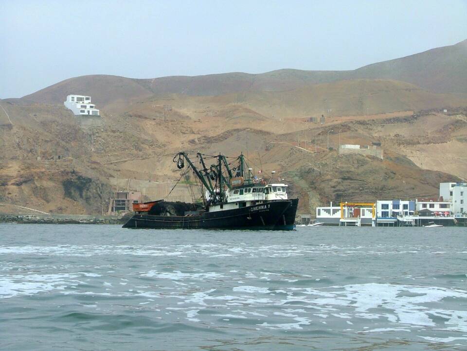
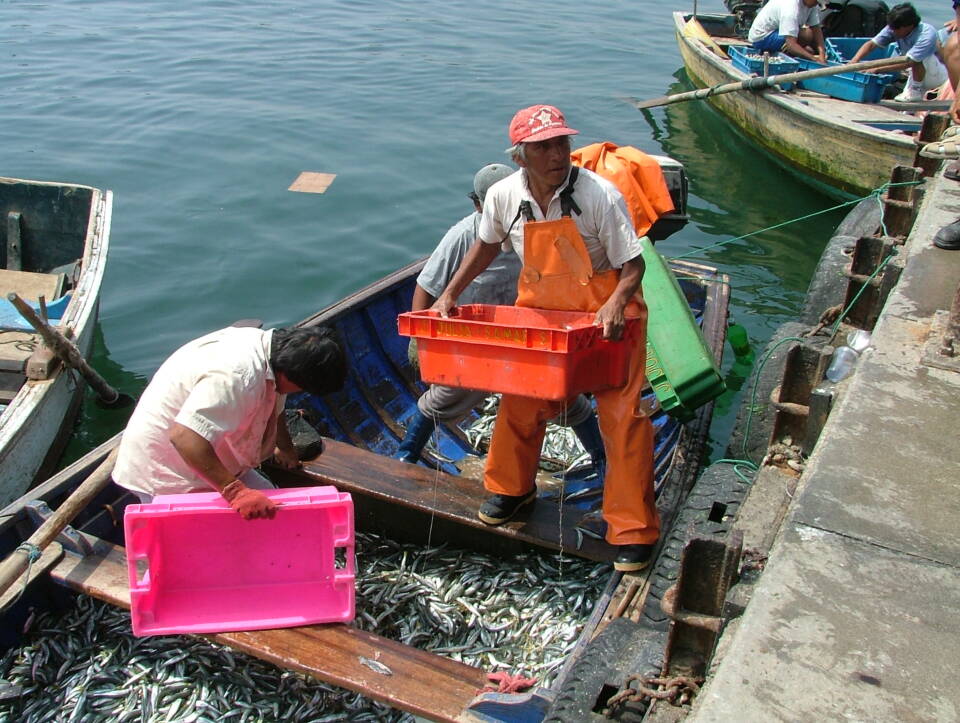
The coast of Peru is cool and arid, yet the Peru Current supports some of the world’s richest fishing grounds offshore.
Peruvian anchoveta is harvested mainly for the production of fish oil and fishmeal.
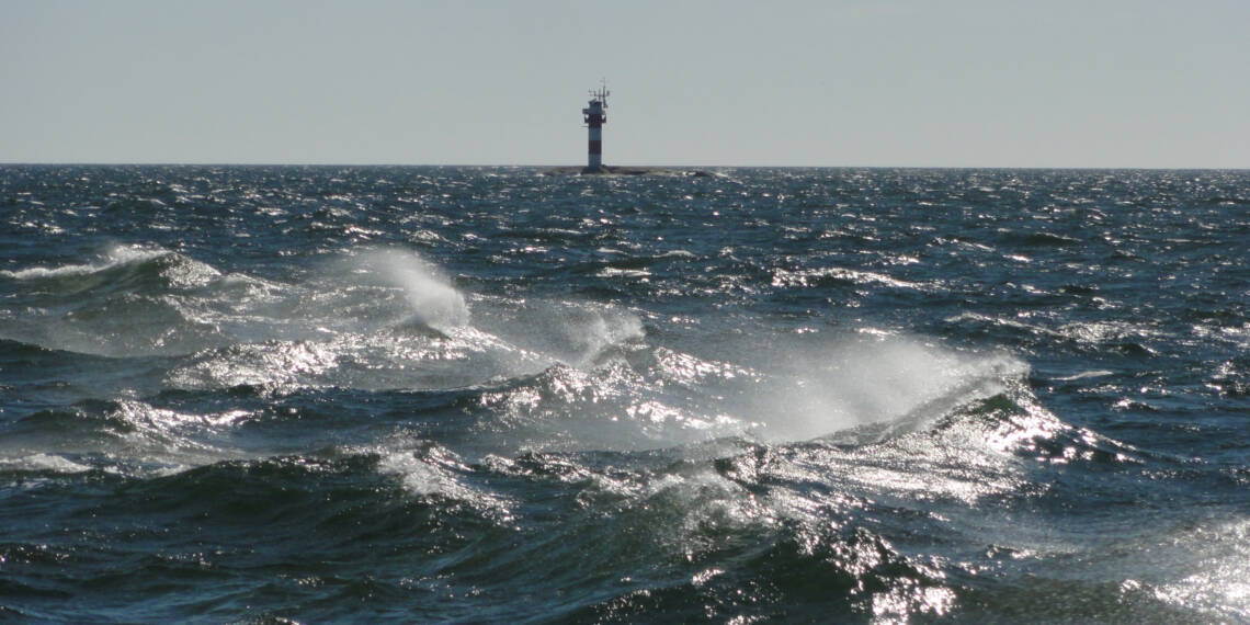
The waters of the global ocean are constantly in motion. These movements are driven by the Earth’s rotation and the planetary winds it generates, as well as by local winds and tidal forces. Ocean movements have a particularly strong influence on the climate and living conditions of coastal regions, but their effects extend far into the interiors of continents as well.
The major ocean currents of the world are driven by the Earth’s rotation and the planetary wind systems it generates. These winds generally blow in the same direction along specific latitudinal belts. As they move across the ocean surface, they push seawater along with them, influencing waters down to depths of around one hundred metres. Ocean currents transport heat, nutrients and marine organisms across vast distances.
The Earth’s rotation also creates the Coriolis effect, which deflects planetary winds to the right in the Northern Hemisphere and to the left in the Southern Hemisphere. Near the Equator, strong trade winds develop. Over the course of the year, they blow from the northeast north of the Equator and from the southeast south of it. The English name trade winds reflects their great importance during the age of sailing ships, when they enabled trade and travel across the oceans.
Tides are caused by the Earth’s rotation and the gravitational pull of the Moon and the Sun on the oceans. When a particular area of the Earth’s surface faces the Moon, the Moon’s gravity pulls seawater towards it, causing high tide. Another high tide occurs simultaneously on the opposite side of the Earth, where the Earth’s gravitational pull is weaker than on the side facing the Moon. Tides are strongest during full moon and new moon phases.
The height of the tides is influenced by local conditions and the shape of the coastline. Along the coasts of Europe, the difference between high and low tide is typically a few metres. In narrow estuaries and bays along the Atlantic coast, tidal ranges can exceed 16 metres. Fishers and other seafarers rely on tide tables to plan their activities. In most places, both high tide and low tide occur twice a day.
The Baltic Sea is small enough for tidal variations to be barely noticeable. The effect of the tides amounts to only a few centimetres. Because of the region’s current patterns, high tide and low tide occur only once a day in the Baltic Sea. In addition, differences in air pressure between the northern and southern parts of the Baltic have a greater effect on sea level than the tides themselves. In Finland, the tidal phenomenon can be observed clearly only in the Strömma Canal.
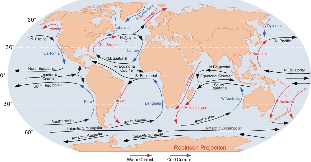
Warm ocean currents always flow from the Equator towards the poles, while cold currents flow from the polar regions towards the Equator. In the North Atlantic, this great ocean conveyor is known as the Atlantic Meridional Overturning Circulation (AMOC).
The Gulf Stream is one component of the AMOC. It transports a vast mass of warm water from the Gulf of Mexico into the North Atlantic at speeds of up to two metres per second. In the middle of the Atlantic, the Gulf Stream divides into three branches. The central branch, the North Atlantic Current, flows northeastwards towards the coast of Norway. By the time the North Atlantic Current and another northern branch of the Gulf Stream, the Irminger Current flowing towards Greenland, reach the Arctic Ocean, they have cooled considerably. There they encounter surface waters that have been diluted by melting ice. Because the waters carried by these currents are saltier, they are also denser and begin to sink towards the ocean floor. At the same time, the direction of flow changes, and cold water begins to move from the polar regions towards the Equator. Water that travelled northwards as a surface current returns southwards as a deep-water current.
The volume of water transported by the AMOC is about one hundred times greater than the combined discharge of all the world’s rivers. This immense circulation helps to warm the climate of Northern Europe. It also increases evaporation from the ocean surface, leading to the formation of clouds that bring heavy rainfall to nearby coasts. Cold ocean currents have the opposite effect. They reduce evaporation and cool the air above the ocean. Moisture then condenses and falls as rain over the sea, leaving coastal regions relatively dry. Along the coast of Namibia, for example, the nutrient-rich Benguela Current supports highly productive fisheries. Yet just a short distance inland, the rich marine ecosystem gives way to the arid Namib Desert.
Whether an ocean current is described as warm or cold always depends on the temperature of the surrounding water. A warm current in a polar region may in fact be cooler than a cold current near the Equator.
In the Pacific Ocean, trade winds push warm surface waters westward along the Equator. As water accumulates along the coasts of Southeast Asia, it is displaced from the coasts of Peru and Chile, where cool, nutrient-rich water rises from deeper layers of the ocean. These nutrient-rich waters support abundant marine life, providing food for fish, seabirds and many other animals while sustaining coastal livelihoods. At the same time, heavy rainfall develops over Southeast Asia and Indonesia, whereas conditions remain relatively dry in the eastern Pacific.
The El Niño phenomenon disrupts this pattern every three to five years, typically lasting for one or two years. During an El Niño event, the trade winds weaken. Surface waters cool in the western Pacific and warm in the east. The upwelling of nutrient-rich water along the west coast of South America declines, affecting ecosystems and local economies alike. Fish catches, for example, can decrease dramatically.
During El Niño events, the extensive warm air mass over the eastern Pacific influences weather patterns across the globe. Heavy rainfall and flooding become more common in the Americas and Africa. Meanwhile, the western Pacific often experiences drought, which has contributed to widespread wildfires in Australia. Hurricane activity in the Atlantic Ocean also tends to increase.
The effects of La Niña are largely the opposite. During La Niña events, seawater temperatures in the equatorial Pacific can be up to five degrees Celsius cooler than average.